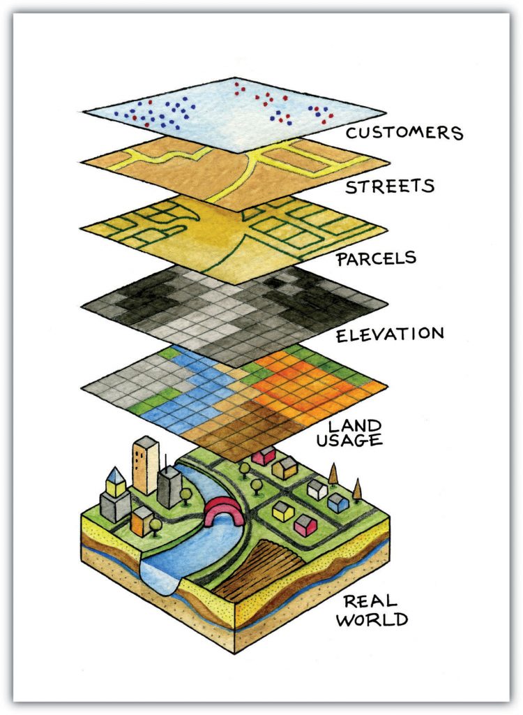
Not points, lines and polygons
We have looked at vector data so far in the labs and tutorials. We understand the relationship between these vector layers. We have investigated how vector geometries and attributes can be manipulated through spatial analysis, and now we are going to look at a different type of spatial data
Raster data

The image above (ESRI Docs) illustrates the concept of raster data. The landcover is captured as a set of pixels similar to taking a photos of the area.
Raster data is everywhere – our cell phone photos or screens, TV screens and computer monitors. Everytime you look to see what quality of camera you are interested in – you look to see how many mega pixels it has. A megapixel is one million pixels – digicamhelp.
In the world of spatial data and spatial analysis, we use both raster and vector data for overlays and analysis. Each of the data models have their benefits and drawbacks.
Raster vs Vector
Both data models are used to represent landscapes, but they are quite different from each other:
Vector data
- Discrete data
– they have edges and borders (you cross a line to get up on a sidewalk) - We think of vectors and points –> lines –> polygons (simple features)
- They have attributes associated with each discrete feature
Raster data
- Continuous data
– the data is a grid of cells with not discrete boundaries - We think of it as a lattice with each cell having a value
- Generally there are no attributes associated with each cell
– the cell itself is the data we are interested in using
Check out the gisgeography site comparing vector and raster – GisGeography
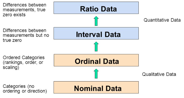
Data held in Raster datasets
The numbers that are held in each cell are an indication of the types information being modelled. We group these number types the same as we would for other fields (i.e. math and statistics):
Number types to remember:
- Nominal
- Ordinal
- Interval
- Ratio
Check out the link below the image from graphpad.com about these number types
Using different types of raster data in the labs
Making use of the different numerical types, we can create or make use of a variety of raster data layers. We should however, pay attention to the numerical types for using these layers for analysis. For instance if we want to perform a subtraction or addition of one raster layer from/to another, we should be using the proper type.
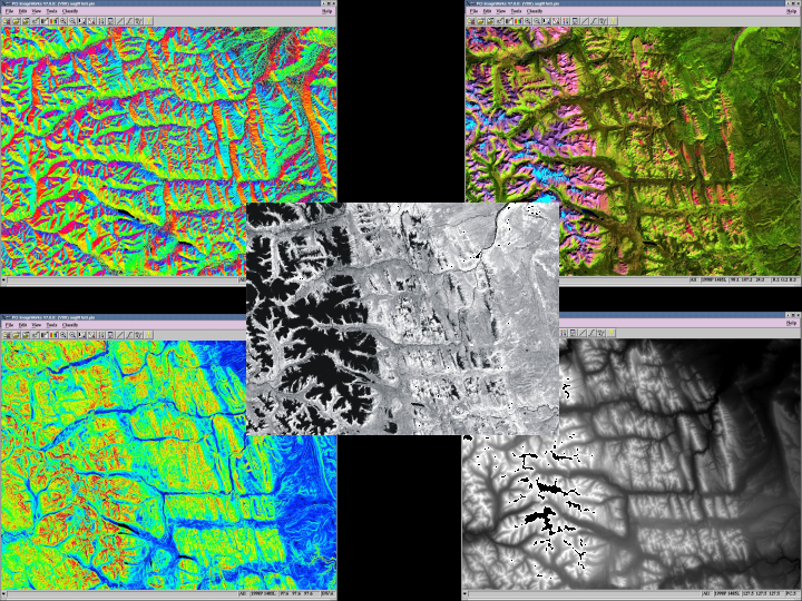
Topographic data – continuous
We will be exploring elevation data in raster format in the lab. This data is called Digital Elevation Models. There are many terrain layers that can be derived from this elevation data. Below are some of these layers as well as satellite imagery, and all are continuous data
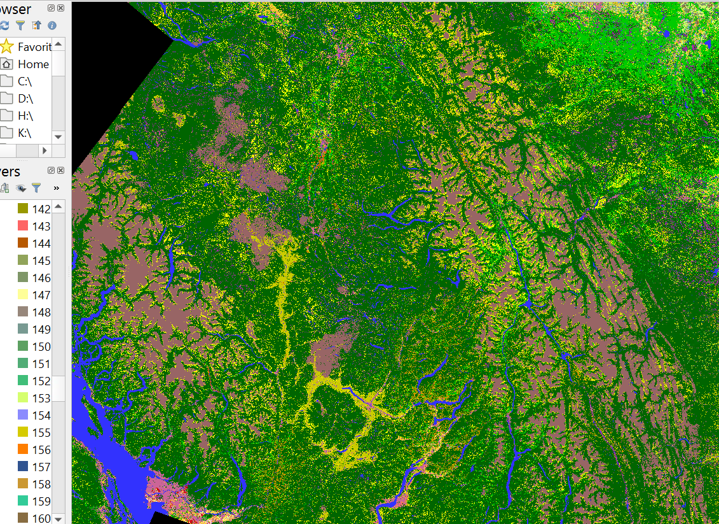
Classified raster data
We will be exploring classified raster data. This data is still in the grid or lattice way of storing data, but is similar to the discrete data types of a vector layers in that pixels are grouped into a range of values.
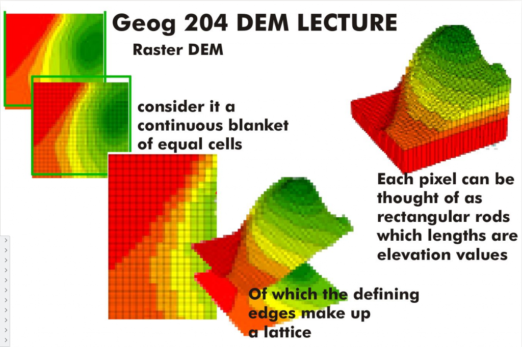
Raster DEM
Continuous values from a raster dataset provide and excellent method for representing elevation
Mixing Vector and Raster Layers
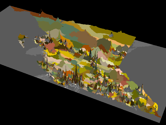
The image above has the Dissemination Layers draped over a raster layer of populations values from Block data. The raster data is used to produce the 3D layer the DA are draped over