The use of Unique IDs to relate census layers
In the lab and tutorial we have looked at Census data in the forms of Postal Codes and Dissemination Layers. In lecture we have looked at the small area layers that can be use for analysis such as: Blocks, Dissemination Area, Enumeration Areas and Census Tracts.
We have a chart that speaks to the pros and cons of each layer, but we should also look to how each layer is represented and how much geography they cover in Canada.
Hierarchy of standard geographic areas for dissemination
Stats Can has provided a nice layout of this relationship. This is very helpful for use in understanding how we can organize layers that are related by geography and by statistics. As we move into using other layers such as resource management or municipal layers, we will find this type of organization is not that common.
It is also very useful to look at the Illustrated Glossary to get a better understanding of how these census units are defined.
If we look at the census tract definition (the glossary and dictionary) we can see how these units are defined and also split up into smaller census tracts as population increases.
We can do the same for dissemination areas.
We see they follow different numbering schemes. This is influenced by layers such as the DAs covering all of Canada and CT only present in urban areas greater than 50 000.
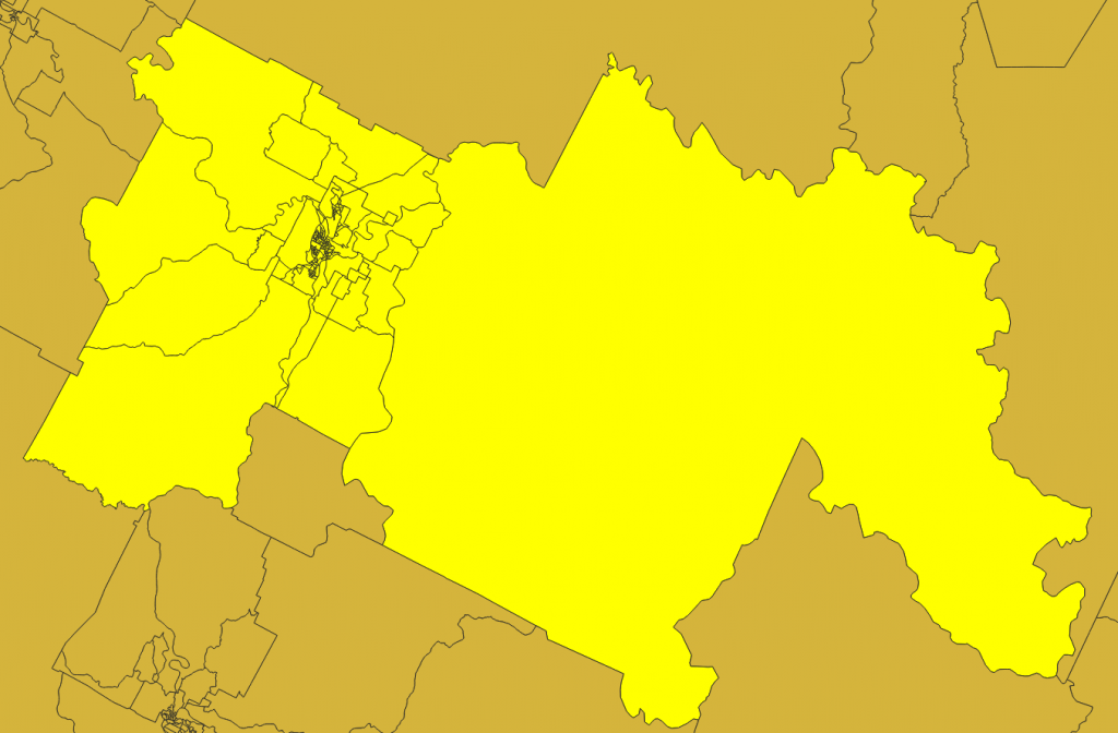
This relationship in and around Prince George
Let’s look at this relationship with some CTs and DAs in the city limits of Prince George
If we look at these geographically we can better understand the relationship between layers.
Census Metropolitan Areas
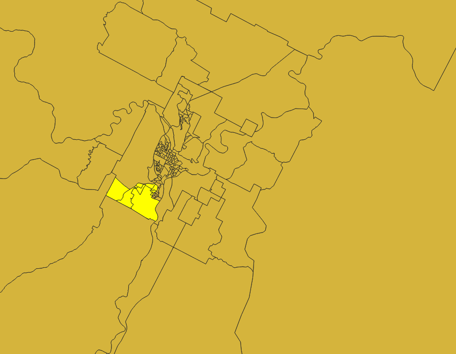
Census tract 970
Census tract 9700003.00 (10 Digits)
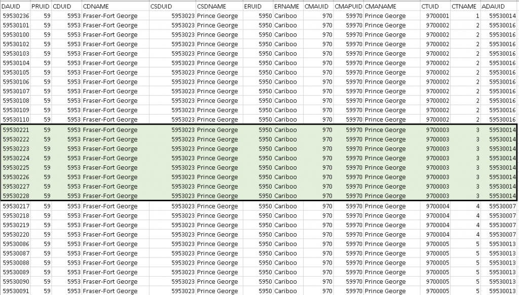
And the attributes associated with the selection
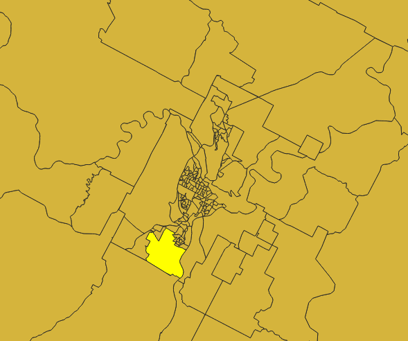
A Dissemination Area in the Census Tract – 59530024 (8 characters)
Things to keep in mind
- How layers are numbered
- The relationship to numbering and extend of geographical coverage
- The numbering between layers
- How layers that cover Canada are related to each other and to those that do not cover all of Canada
- The process by which census boundaries can be split into smaller polygons and renumbered