What are we going to do this year
This year will be a bit of an adventure in getting to know GIS. In fact we will be stumbling along together to learn the fundamentals of GIS to the use of GeoSpatial technologies in general. This means we will be using standard GIS software as well as learning some web based protocols to blend in some classical GIS to contemporary geospatial practices.
The course structure consists of a lecture, tutorial and lab per week.
The lecture is what most students expect as the session to introduce concepts and examples of GIS and other GeoSpatial concepts.
The tutorial session will be used as mostly for learning different technical techniques, that do not necessarily require the use of geospatial software. The tutorials may occasionally be used for the lecture based materials .
The labs are primarily used for educating students on the use of software.
As the course is based on using computers heavily (often called applied, hands on or experiential learning), there is a propensity to have many assignments rather than testing. In a non-covid year, we would have more testing and less assignment based evaluations, but as testing in an online environment – there may be more “take home” projects.
What is GIS – Some basic concepts
There seems to be a pattern of 3s in this field – such as the name itself..
GIS = Geographical Information System (A Canadian invention)
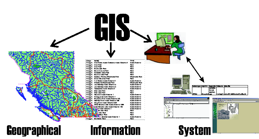
Geography
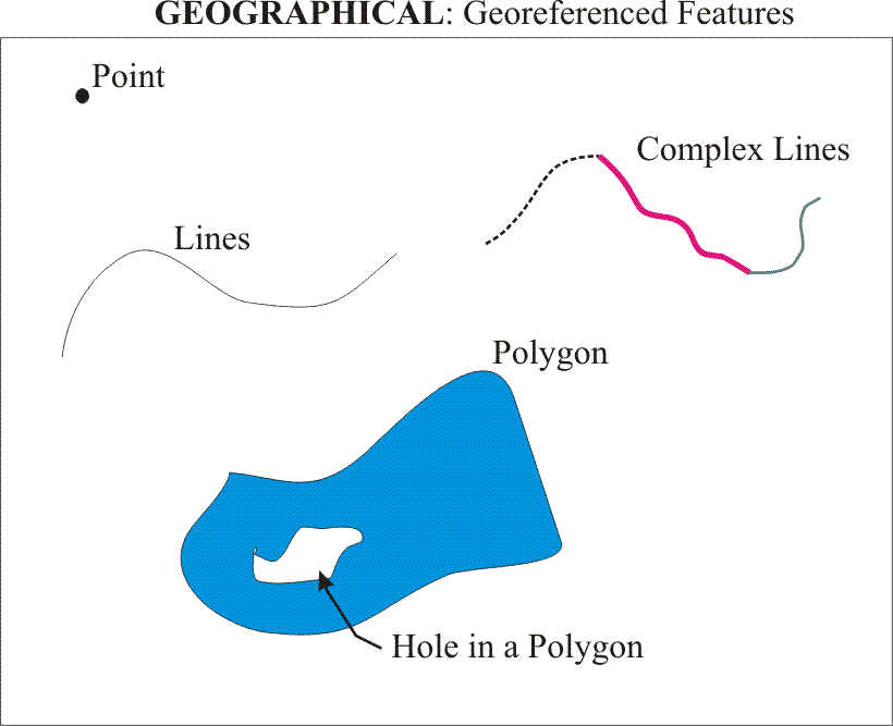
Features (we will discuss this in tutorial next week) such as the ones illustrated above are located in space in some sort of a coordinate system and have qualities that set them apart from each other. Lines can lead to complex lines –> to closed lines (polygons) and changes in direction or type can be marked with points. Think of Features as objects you will find on the land – such as lakes, rivers, roads, buildings and points of interest. We use GIS software and other spatial software to create and store these features digitally.
For Geog 204, we will generally be using a file type that can contain one feature type at a time (either Point, Line of a Polygon). We will discuss this later in this lecture.
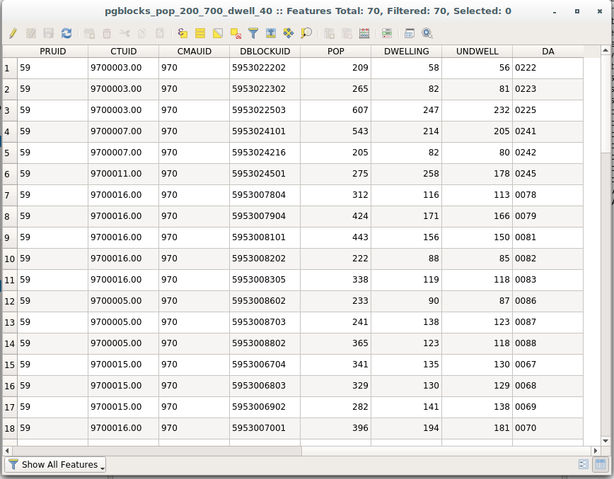
Information
System
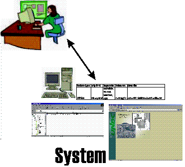
The system in GIS is a combination of hardware, software and users. Classically GIS work had been done through a central computer environment or specifically designed workstations. This classic approach made use of proprietary software and highly trained people with a deep knowledge of GIS techniques.
This is not the case anymore as software can be obtained for free and can be used on a variety of hardware. Still, the system is often thought of as specialized equipment operated by grump coffee guzzling technology geeks
Historically GIS has been considered a tool
A GIS provides results from data input and analysis based upon a query put forth.
Common steps in this manners are:
– A GIS specialist is given a problem to solve based on qualities described by other professionals
– This specialist assembles the necessary data to complete the task
– these data modelled and analyzed
– descriptive products that attempt to provide solutions for the problem are provided(such as maps, tabular information or statistics).
GIS and other geospatial fields are so interwoven in other technologies and applications. These applications are used by so many people that a certain amount of geospatial knowledge is becoming common place. This specialized perspective is being replaced with the need for people having fusing an understanding of the underlying technologies with the ability to see the broad application of the uses of GIS and similar fields
Movement to newer GIS strategies
In this course we will take these foundations of GIS and investigate approaches that are moving GIS into a method of integrating many fields of interests from a set of tools primarily used for land use concerns. Contemporary GIS uses many of the same techniques practised in Computer Science for acquiring, storing, manipulating and sharing data. Some of the newer fields and standards that have evolved are:
We will be discussing newer methods of standardizing as well as expanding the use of spatial data for an increasing human need for spatial information.
As GIS is becoming more widely used in all types areas the methods by which it is used is constantly being updated and improved upon. This has resulted in people other than GIS professionals needing to understand and apply some of these newer techniques. This expansion of GIS has lead viewing GIS as a science rather than strictly a technology or tool, and has spawned newer expressions such as GISciences, GITechnologies and GeoSpatial science and technologies.
Maybe we should create a new term and acronym called Spatial Information Technologies – maybe not as it would be SIT…
Tutorial and labs next week
We will go over some more terms in the tutorial next week (in combination of using our geotagged photos) that will lead into the lab exercises next week