Creating a shapefile from point data
Create a CSV
The data you are going to use is in the Tutorial 2 folder on the L drive (L:/geog 204)
Create a folder on the K drive where you will save your work for this tutorial
1 Open Excel and create a new spreadsheet
2. Select the Data tab
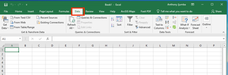
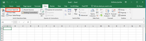
3. On the far right, select “From Text” option.
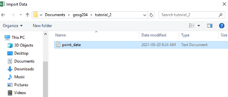
4. Find the TXT file on your computer and click “Open”.
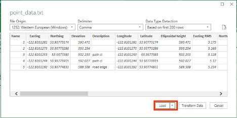
5 Note that the “Delimiter” option is “Comma” and that “File Origin” is set to European Windows. Choose “Load”
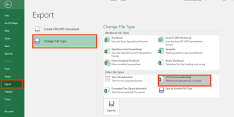
6. Go to the File menu choose Export and save the file as .csv

Import CSV File into QGIS and Create a shapefile
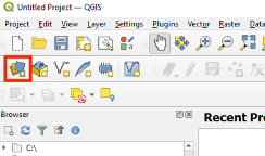
First open Data Source Manager and click “Delimited Text” on the left to select the CSV file to be imported.
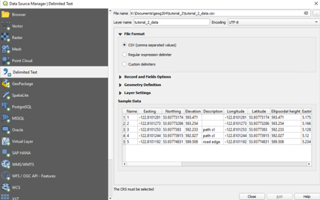
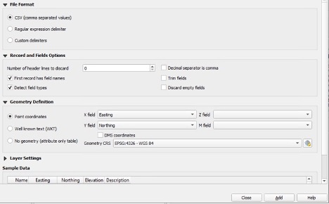
Make sure to check on or enable appropriate optional items as shown above and click “Add” button to add the CSV file to Layer’s panel of QGIS.
Now Create three different shapefiles
Create a points shapefile
- Right Click on the layer select Export >> Save Features As
- Specify the format as ESRI shapefile
- Specify the File name and where you want to save it.
- CRS make sure it is correct (ESPG: 4326)
- Click OK
- Right Click on the new shapefile >> Show Labels
- Again, Right Click >> Properties >> Labels >> Value: Description
- Click OK
Create a polygon shapefile
- Go to the Layer menu >> Create Layer >> New Shapefile Layer
- Specify the file name and the location where you want it saved.
- Geometry Type: Polygon
- In the New Field group:
- Name: Description
- Type: Text Data
- Click OK
- Right Click on the Polygon shapefile you just created
- Toggle Editing Click the Add Polygon Feature
- Click the Add Polygon Feature
- Trace a polygon that follows the “road edge” points to create a polygon that represents the road. To finish creating the Polygon feature, simply right-click and type “road” in the Description field. Click OK
- Click the “Save Layer Edits” button
Create a shapefile for lines
- Repeat step 2 above to create a shape file with geometry type LineString. This is shapefile is for creating the center line of the path.
Now export the shapefiles to KML
- Export all 3 shapefiles to the KML format.
- Hint: remember the first shapefile you created?
- Import them to Google Earth Pro.
- Where was this survey taken?