- BC TRIM
- QGIS:
- ArcGIS Pro:
- Open Street Map
- WMS Tiles
- Vector Features
- BC DEM (1:20,000)
- World DEM (3″)
- World Administrative Boundaries
- Municipal Data
- Prince George
- Kamloops
- Earth Explorer
- Open Data Hub
- British Columbia Data
- National Topographic System (Canada)
In the Lab:
BC TRIM
NOTE: The BC TRIM dataset is very large, attempting to load certian layers for the whole province may take an excessive amount of time. Please zoom in on your area of interest before loading the layer.
After you have loaded a layer for your area of interest consider exporting your extents as a local file for continued work.
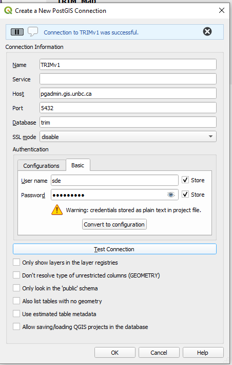
BC TRIM v1 data is available via a PostgreSQL database.
You can connect to the database with the following settings:
host: pgadmin.gis.unbc.ca
port: 5432
user: sde
password: unbc-user
database: trim
schema: trim
QGIS:
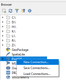
In Browser right click on PostGIS and select new Connection.
ArcGIS Pro:
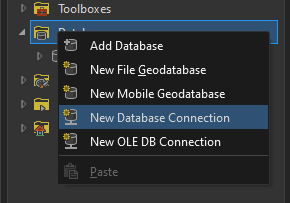
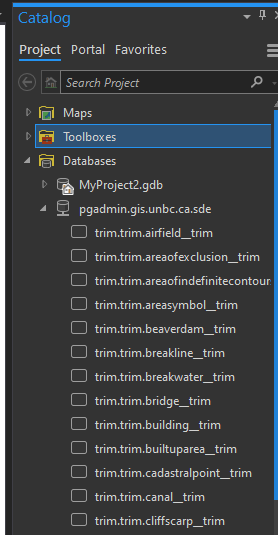
In the Catalog pane, right Click on Databases then New Database Connection
Log in with the account information listed above
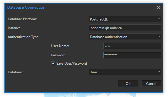
All the layers will be available in the database section of the catalog.
Open Street Map
WMS Tiles
\\TODO (map.gis.unbc.ca/????)
Vector Features
\\ TODO (PostgreSQL)
BC DEM (1:20,000)
\\TODO (L: Drive)
World DEM (3″)
\\TODO
World Administrative Boundaries
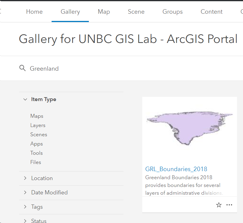
Log into https://arc.gis.unbc.ca/portal (You will not be able to access boundaries without signing in)
Your username is your standard UNBC username followed by @UNI (eg doe@UNI), and your password is your standard UNBC Password.
In the gallery simply search for the Country you would like to access:
External Sources:
Municipal Data
Prince George
https://data-cityofpg.opendata.arcgis.com/
Kamloops
https://mydata-kamloops.opendata.arcgis.com/
Earth Explorer
\\TODO
Open Data Hub
\\TODO
British Columbia Data
https://catalogue.data.gov.bc.ca/dataset?type=Geographic